|
|
| Hilo, Hawaii |
|
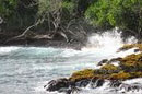
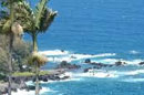
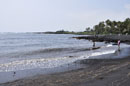
Isaac Hale Beach Park |
| |
|
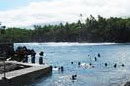
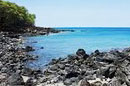
Take Highway 130 south from Pahoa. When it dead ends at Highway 137, turn right. This Park is on the left, near Mile Marker #11.
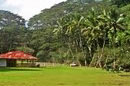
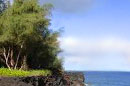
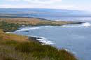
Isaac Hale Beach Park, also known as Pohoiki is an oceanfront park, boat launch and surf location along Pohoiki Bay in the Puna district of the Big Island of Hawaii.Pohoiki Bay is known for its strong currents and although the park is known for good snorkeling, conditions are usually not ideal. Grass and shadey areas, picnic tables, picnic pavillion, restrooms. |
| Hilo, Hawaii |
|
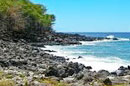
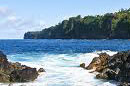
Kapa'a Beach Park |
| |
|
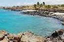
Take Highway 270 north from Kawaihae. Turn left at the road just past Mile Marker #16 to the beach parking area.
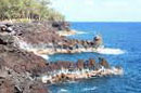
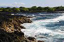
Kapa'a Beach Park is a rocky beach is good for snorkeling and scuba diving. The water is clear and usually calm. Offshore there are good views of the neighboring island of Maui. Sunsets are great. Facilities: Picnic tables. BBQ grills. Restrooms. No lifeguards. |
| Hilo, Hawaii |
|
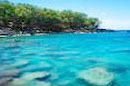
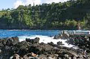
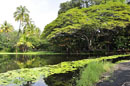
Kolekole Beach |
|
|
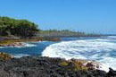
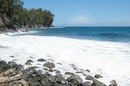
From Hilo, drive north on Hawaii Belt Road for about 10.5 miles (16.9 km). A sign marks the turnoff to the park on the right.
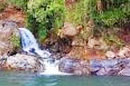
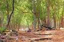
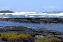
Kolekole Beach Park is a popular beach park with beautiful scenery, spacious grassy areas and facilities. Great place for picnic and fishing. Swimming in ocean not recommended due to rough conditions. No lifeguards.
|
| Hilo, Hawaii |
|
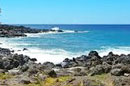
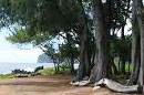
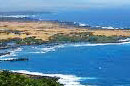
Laupahoehoe Point Beach Park |
|
|
From Hawaii Belt Road (Hwy 19), turn onto Laupahoehoe Point Road (near mile marker 27). Follow the road for about one mile (1.6 km) to the ocean.
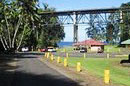
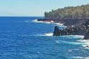
Laupahoehoe Point Beach Park is scenic peninsula on the Hamakua Coast. It is a nice spot for a picnic and picture taking, fishing. But when it comes to water activities, the options are limited. Facilites: showers, restrooms, picnic tables, pavilion with electricity, county-maintained boat ramp, parking. No lifeguards.
|
 |
| Hilo, Hawaii |
|
MacKenzie State Park |
|
|
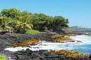
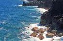
From Pahoa, take Highway 130 south. At the dead end at Highway 137, make a right turn. Highway 137 turns into Pahoiki Road for 2 miles and then Highway 137 turns left. Follow the highway until you see the park on the left after Mile Marker #137.
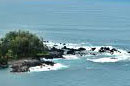
MacKenzie State Park is part of King's Highway, an ancient Hawaiian trail, is located here. Beautiful landscape and ocean views. Swimming is not safe in this area due to very strong currents. Good shoreline fishing but don't too close to the edge of the cliffs. Facilities: restrooms, pavilion, picnic tables, camping area, parking. No lifeguards.
|
|
| Hilo, Hawaii |
|
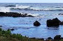
Punalu'u Black Sand Beach |
|
|
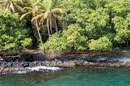
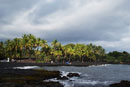
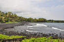
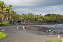
Punalu'u Black Sand Beach is located on the Big Island's southeast shore, between Na'alehu and Pahala (between mile markers 55 and 56), off Highway 11.
Most popular black-sand beach on the Big Island, great place to see sea turtles. There is a boat/kayak ramp that's open to the public. Swim should close to shore. Facilities: showers, restrooms, picnic tables, pavilions, drinking water, souvenir shack, camp sites, parking. No lifeguards.
|
| Hilo, Hawaii |
|
Whittington Beach Park |
|
|
The beach park is located off Highway 11, between mile marker 61 and 62.
Whittington Beach park is a small beach park with a picturesque shoreline, No water activities possible, but good place for a picnic. Camping needs permit required. Facilities: showers, restrooms, picnic tables, parking.
|
| Copyright 2012 Hilo Magazine |
|
|